Wednesday Update
Issued Tuesday Morning

TIMING-
No real changes from yesterday. This system moves in from the west late tonight while most of you should be asleep. A snow/rain line will set up across southern New England and will creep northward into the early morning of Wednesday. This like will slowly work its way north and by day break, will pull north fairly quickly. This system wraps up by midday Wednesday in southern New England, mid afternoon for the MA/NH border, and will continue across the north country well into early Thursday morning.
A secondary low develops off the southern coast during the morning Wednesday. This will help to re-energize this system.
P TYPES-
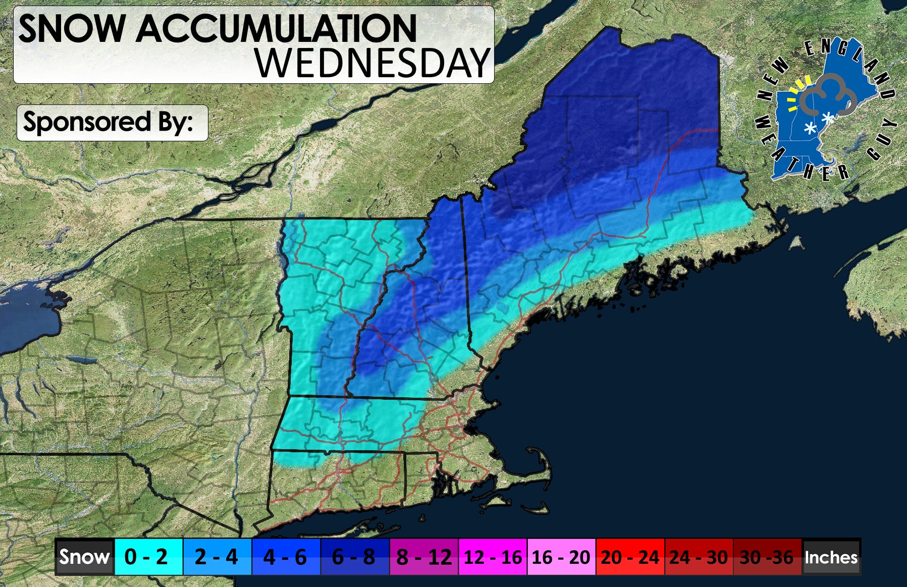
Snow and rain are still expected. A slight change to the accumulation map. I still see the higher elevations along the middle of Vermont and Monadnocks of NH, and even western Massachusetts picking up 2-4 inches with some areas maybe a little more. I think these areas will take a bit longer to change over to rain and will likely gain a few of these inches as heavy sleet before much of it washes away.

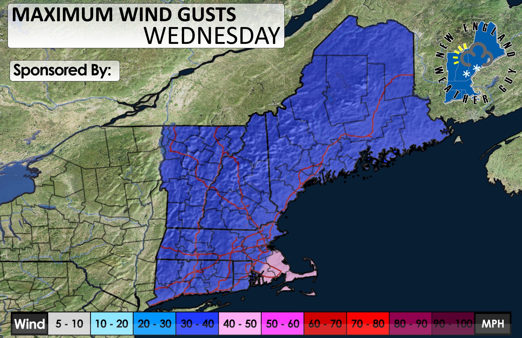
ADDITIONAL HAZARDS-
Wind is still likely to gust around 20mph on average with higher gusts likely for the coast and higher elevations. Some interior gusts could reach 30-40mph as we go throughout the day Wednesday. Scattered power outages are possible, but probably not widespread.