
Wednesday-Thursday Update
Issued Tuesday afternoon

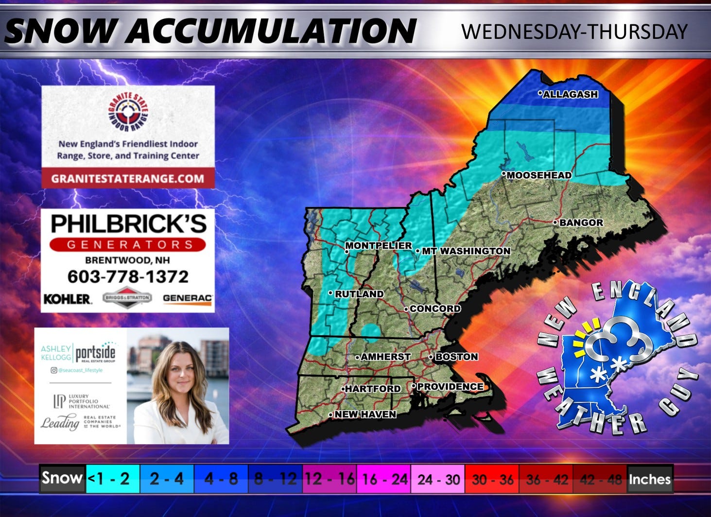
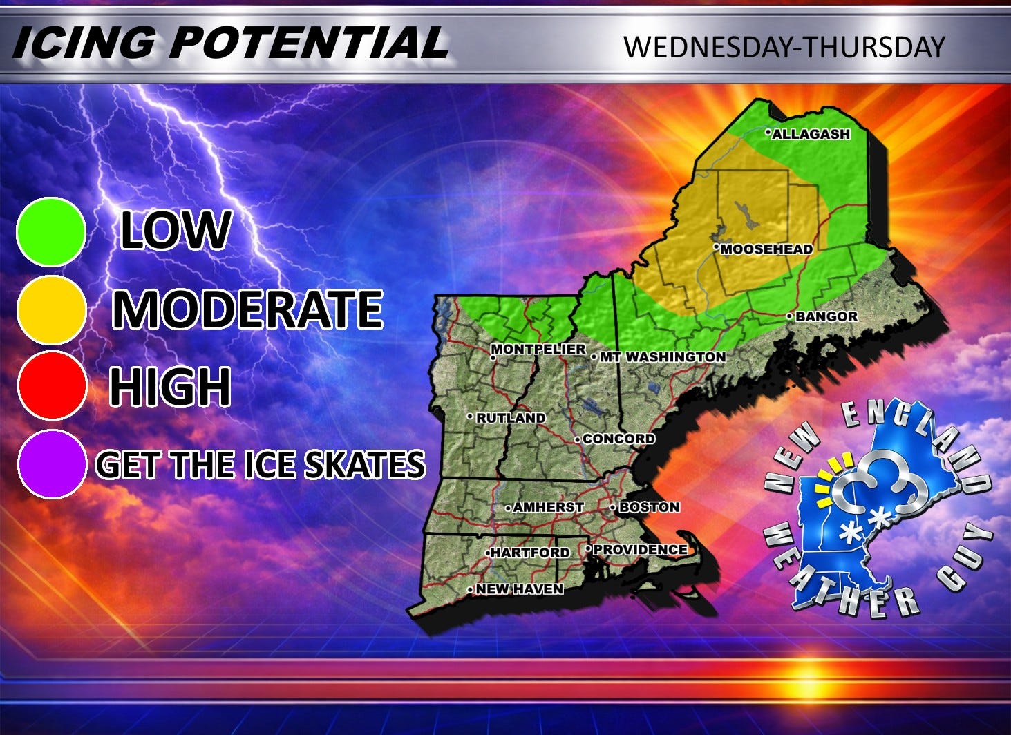
Precipitation enters the region by 8am Wednesday morning. This initial burst starts off as rain. As the system reaches northern New England by 11am, it will change over to a wintry mix of snow, sleet, and freezing rain, for northern Maine ONLY. Everyone not in northern Maine will see plain old fashioned rain. Showers at best. Some showers may be longer lasting, and some may be heavy at times. Precipitation should be about done by late morning Thursday.
As we progress through the day and into the evening, we will see a drop in temperatures to below freezing and by Thursday morning, we will see some quick bursts of snow down into Vermont, New Hampshire, and northwestern Massachusetts.
No, there will not be a timing map associated with this system due to the unpredictability of the showers
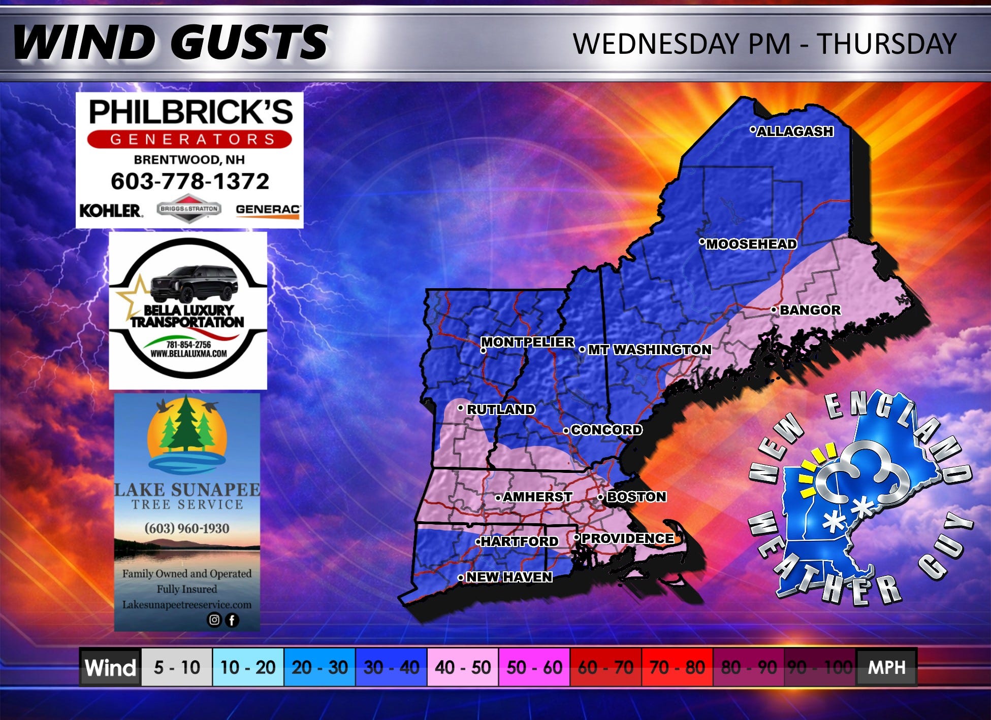
Winds Wednesday evening into Thursday will be gusting in the 30-40+ range as an arctic cold front enters the region.
Next system is Friday afternoon into Saturday. As of now, that is a mostly accumulating snow event for the entire region with southern New England changing to rain Saturday morning.