Up next, more snow...and rain.
Issued Tuesday Morning

While we let this current storm play out, we are looking ahead to the next few.
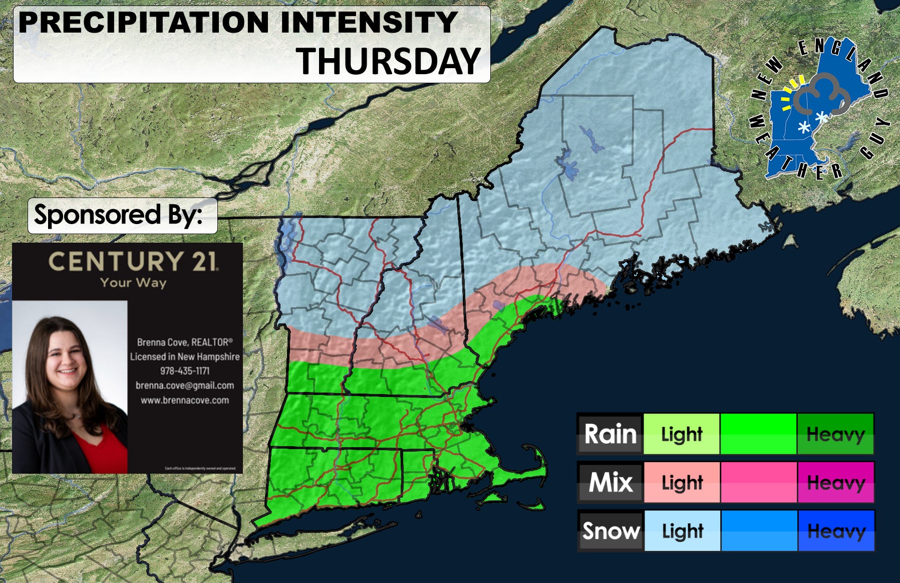
THURSDAY- Relatively small disorganized system will move in during the morning through afternoon bringing scattered rain and snow showers, as well as a general area of mixed precipitation. Little to no accumulation is likely with temps in the mid 30’s to low 40’s in southern New England, and temps at or below freezing the farther north you go.
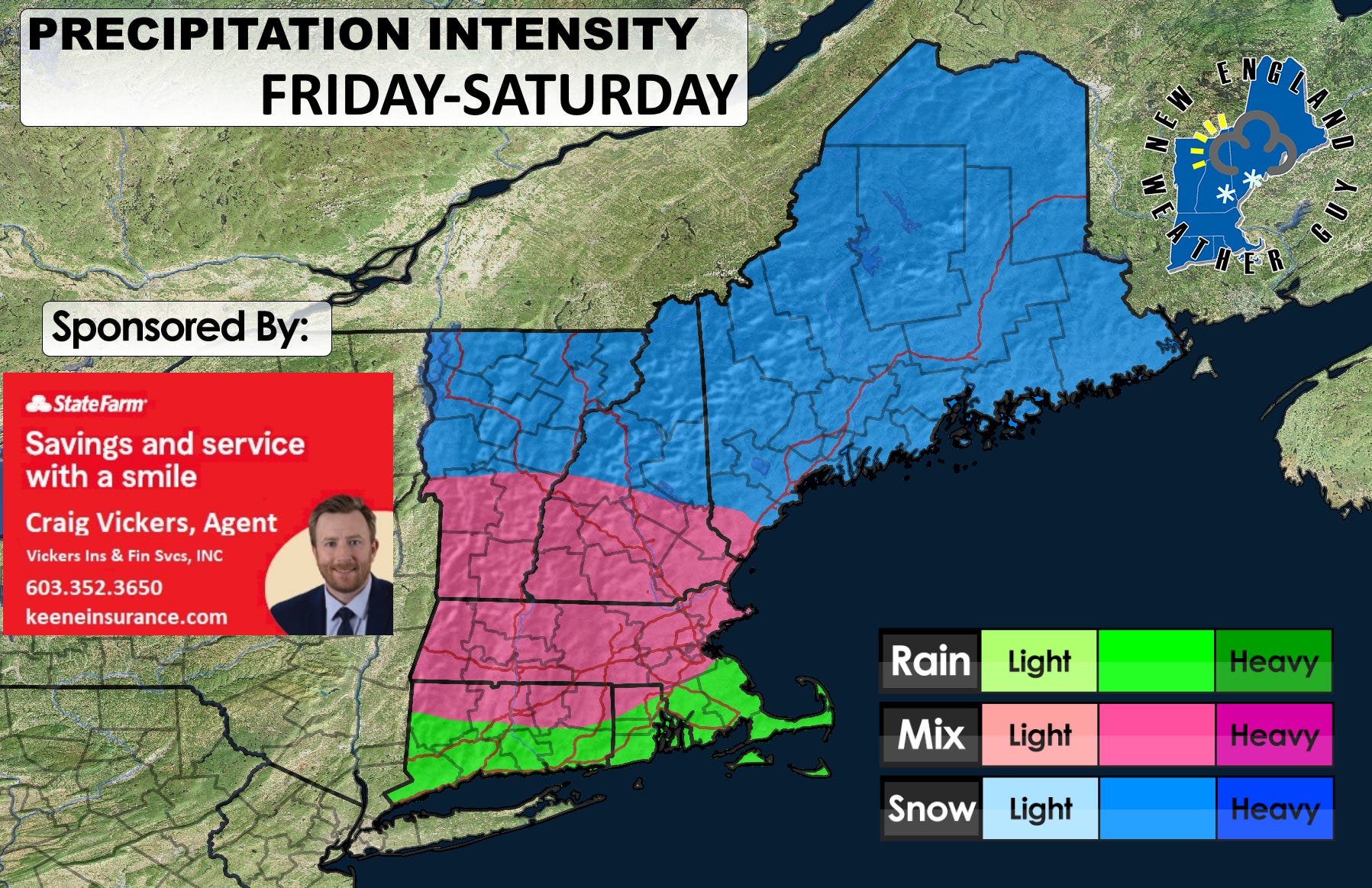
FRIDAY through SATURDAY- This is a larger system that looks to bring moderate snowfall, as well as rain in the south and a large chunk of wintry mix and sleet across the middle section. This tentatively starts late Friday afternoon and continues through all day Saturday. Accumulations of snow are showing on the models as moderate in the 8-12 range up north, and 4-8 on the southern end…. but we will see as we get closer.