Tuesday-Wednesday Update
Issued Monday Evening
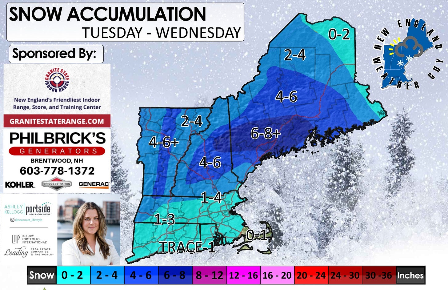
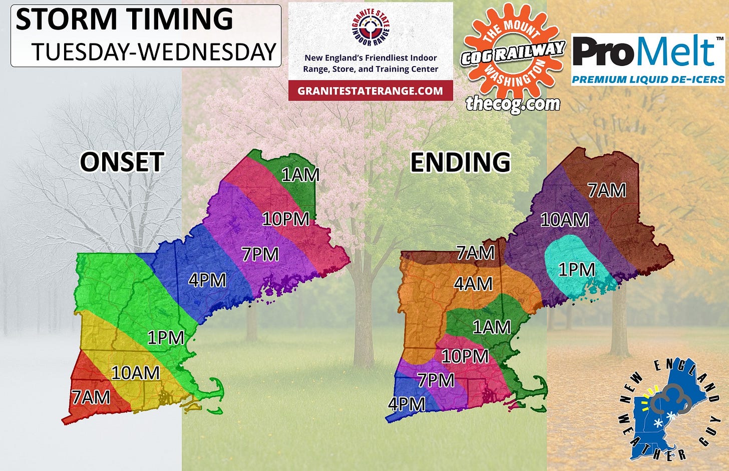
Timing has moved up a bit for some, and I have adjusted the snowfall map.
This event has been a bit difficult for some folks to follow as it is a two-part system. When the first part finishes in one area, it picks up again in another, which is why the timing map looks the way that is does.
Really simple and easy... the best place for snow is from Old Orchard Beach, Maine up to the White Mountains of NH, over to Monson, Maine, and then down to Bar Harbor, Maine. Anywhere else, it is not guaranteed.
This event, even being a long duration, will average about 2-4 inches. Because we will also be on the warmer side for much of this, this will be highly elevation dependent.
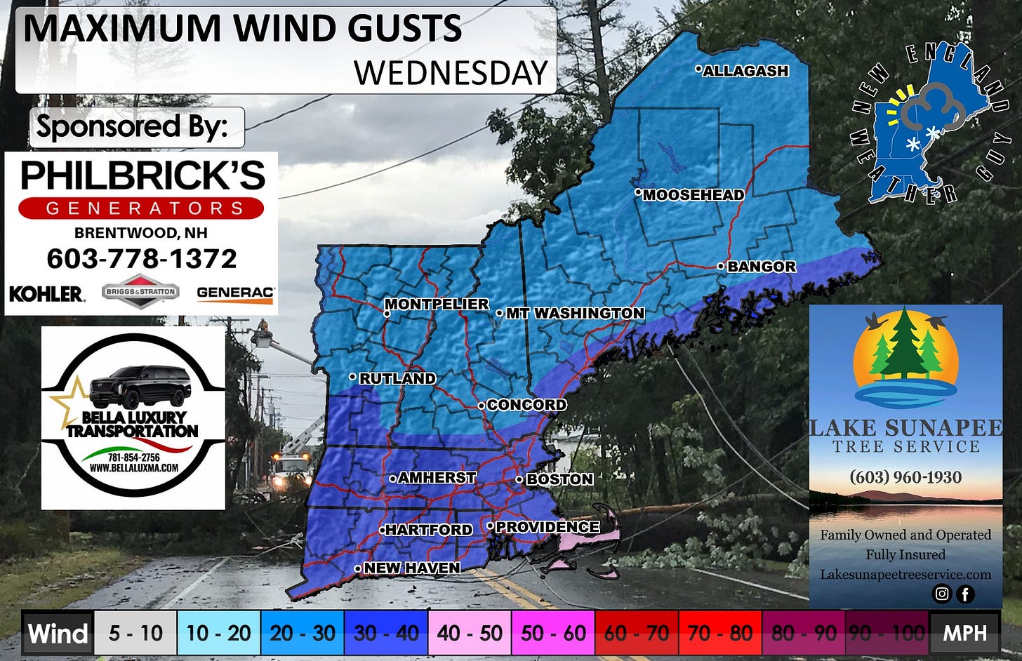
The back side of this Wednesday will include some wind. See the attached map for that.
We have another system for Friday into Saturday that looks to be all snow, and another Sunday night into Monday that is snow in the north and rain south.
We will not enter the active tracking phase of coverage and unless anything drastic changes overnight, the next update will come via radar in the morning.


