Tuesday-Wednesday Update
Issued Monday Morning
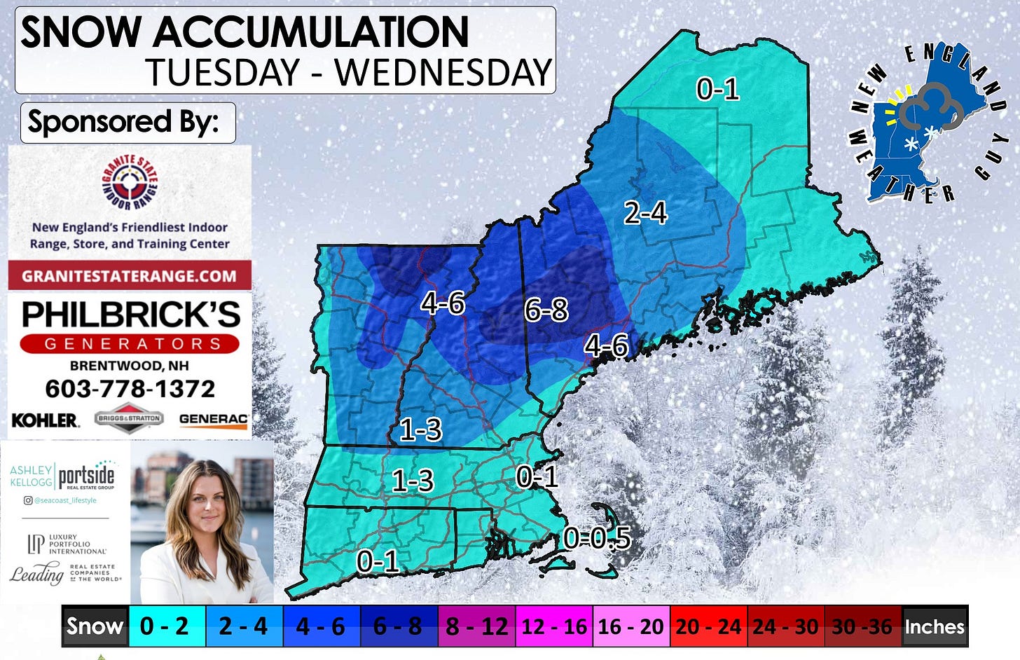
No significant changes to the timing. I did update a few areas of the accumulation map and added some numbers to the map so you can get a better idea. I will be posted a more finalized map later this evening.
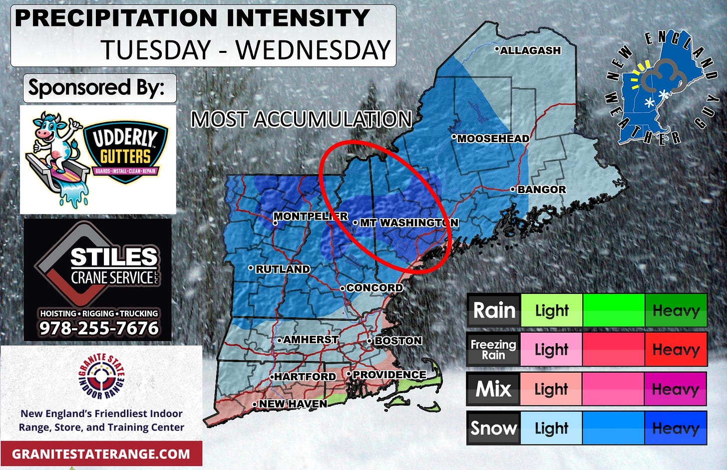
For the most part, we are watching to systems play bumper cars in the areas between Portland, Maine and Pittsburg, New Hampshire, with the opportunity for 20-30 miles of deviation to either side. This is the area where the highest totals will occur, other than down the Green Mountains and the higher elevations of the White Mountains.
For southern New England, snow moves in around 7am and is pretty much done by 4pm.
For areas in southern NH and VT, up into the Rt 89 corridor, snow starts around the 9-10am timeframe and will last into the evening around 7pm, possibly finishing as rain on the backside.
Northern NH, VT, and southern coastal ME, your snow starts in the afternoon around 1pm and will continue into the early morning hours of Wednesday around 3-4am.
Midcoastal Maine into northwestern Maine, snow starts in the late afternoon Tuesday around 3-4pm, and lasts well into Wednesday morning around 10am.


