THURSDAY UPDATE
Issued Tuesday Afternoon
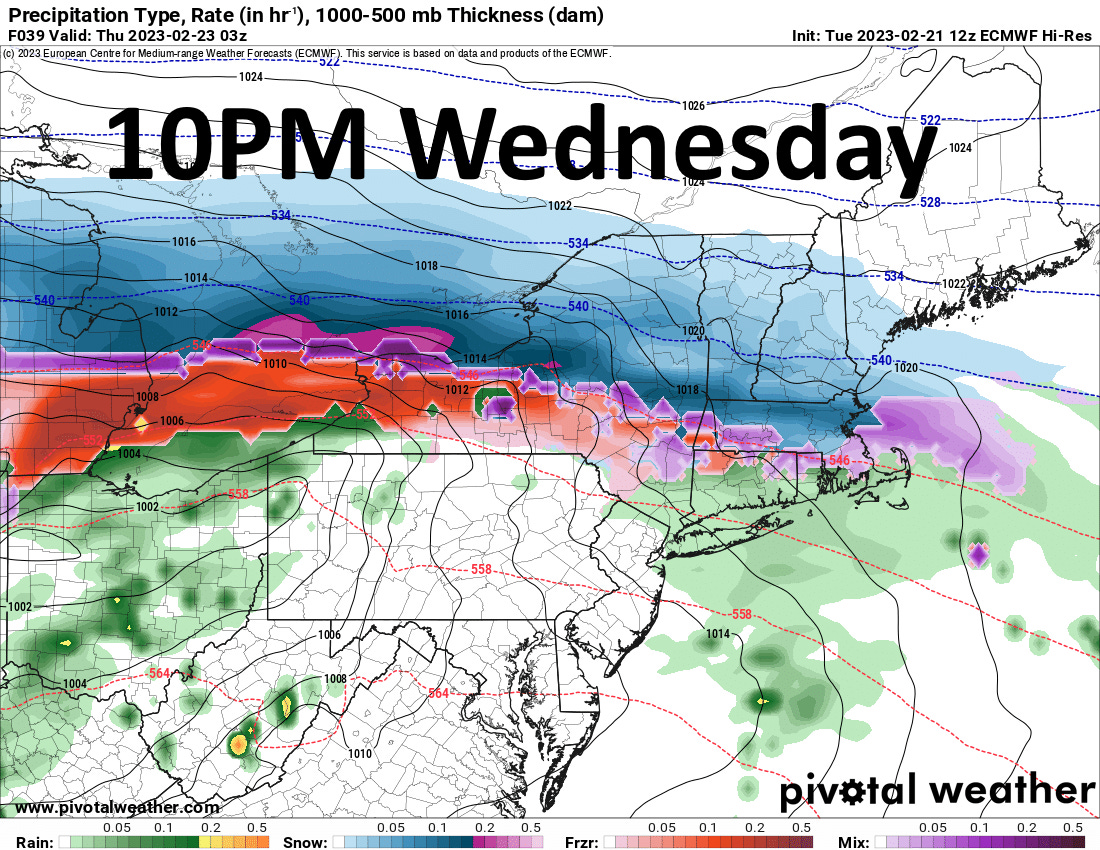
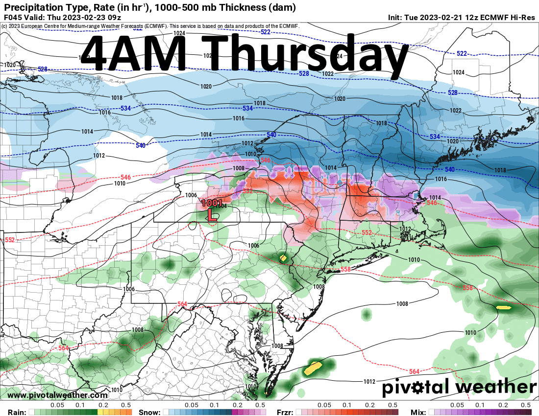
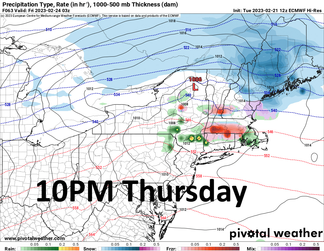
I will try to use the following graphics as a timeline so you can see exactly how this will look. The accumulation side of things is still uncertain. We are seeing a lot of changes across a few top models in the most recent runs and trying to build a trend right now is becoming difficult, so we might just have to shoot from the hip old school for this one.
As for the freezing rain portion of this, it will be enough to make things slick, but I feel air and ground temperatures will be too high for us to see a true icing event. I do think that conditions will be slick Thursday night and into early Friday morning, but road crews should have a good handle on this by that point.


