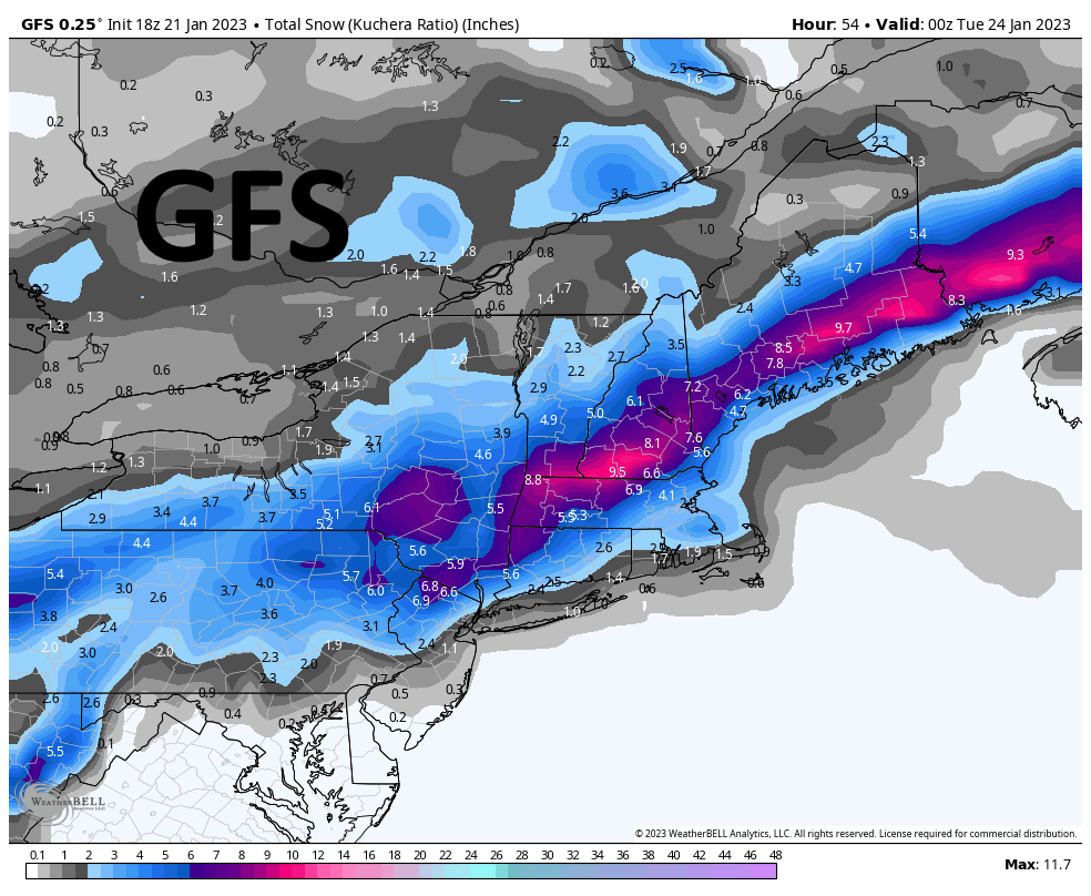
Modeling across the big 3 models has shifted a lot since this morning, and now they are all coming together to show almost the same thing. A big shift southeast. I touched on this earlier, and now modeling is in concurrence.
What we see is the storm system coming together in the Gulf of Maine and pulling in that cold arctic air out of the north/northeast. This moves the chains on snow totals to the south and east where we were looking at all rain before.
I am including the 3 models that I am looking at so you can see what I see.
Nothing is concrete right now as we know from past experience, not to trust a single model run showing something different, but comparing the last runs to the current runs, we are beginning to build a trend. If this storm shifts a little farther east, we could be moving the snow totals again. A final update will be issued in the morning, unless something new develops tonight. This could turn out to be a decent storm after all.


