Snow this week?
Many people will look at this map and question it because there are not any storms coming through this week. This is all the result of snow showers. In fact, many areas of central Vermont have received almost a foot of more (more north) in the past few days.
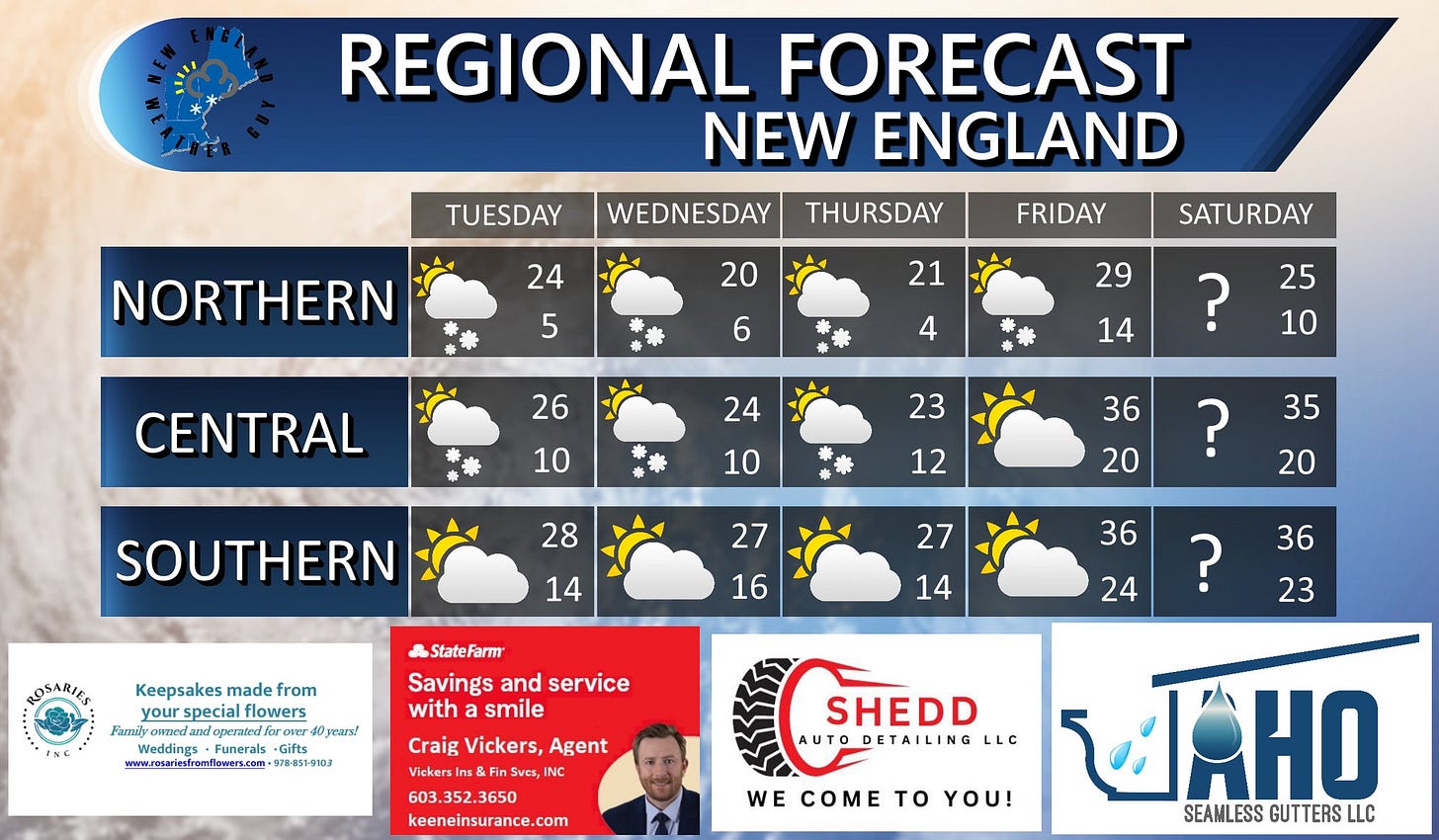
Another round or snow showers will pull in out of Canada Tuesday and stick around until at least Friday. Keep in mind, the majority of the accumulating snow will be kept to the higher elevations of northern Vermont and New Hampshire as well as far western Maine. This is not a widespread snow event. Some showers could dip farther south through the week bringing a dusting to a coating across parts of Massachusetts, southern New Hampshire, and Maine.
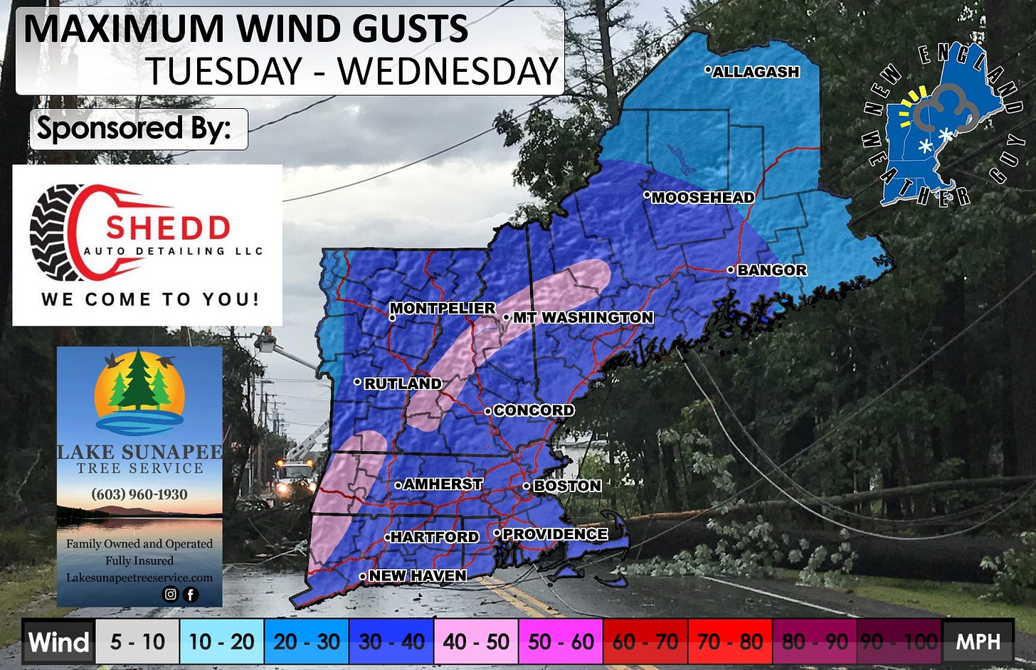
Wind returns Tuesday into Wednesday making our already cold temperatures feeling like they are in the single digits and negative numbers. The morning bus stop tomorrow will be frigid.
A mild warm up looks to come Friday where most of the region should pop up above freezing for a short period of time just before dropping back down again.
Still watching the potential system for next weekend. It is either going to be a cut and dry hit, or a miss. There isn't really an in-between with this system. Right now, there is a system forming over California. Nothing much, but it is the start to the potential weekend system. This needs to head south to pick up moisture and then get slingshotted north by another system that will form later Tuesday. If this happens, then we will start talking how much on Wednesday. If this does not happen, then we are looking at partly cloudy and cold.


![May be an image of 2 people, map, snowplow, ski slope and text that says 'SNOW ACCUMULATION TUESDAY TUESDAY-FRIDAY - FRIDAY Z Sponsored By: FULL-SERVICE BRANDING Photography Advertising Printing •ALLAGASH www .ZOUZMEDIA.GROUP •MOOSEHEAD THE RIVERHOUSE CAFE MONTPELIER •mT WASHINGTON •BANGOR Love, Peace 4Bacou BaconGrease Grease BREAKFAST AKEAST •LUNCH ·LUNCH DINNER 67UNIONS ZAHIOK AILFORD D3055 (603] 249- 49-5 5558 •RUTLAND NT STATE RATR •CONCORD •AMHERST •BOSTON Since 1846 HARTFORD HARTFORDPROVIDENCE •PROVIDENCE •NEWHAVEN- Snow 0-2 2-4 4-6 BAY BAYSTATE ・… SALT BULK ULKWINTERSALT 833-327-8763 www.baystatesalt.com 6-8 8-12 1212-1616-20 16 16- 16-20 20 20-24 24 30 20- 24 Inches' May be an image of 2 people, map, snowplow, ski slope and text that says 'SNOW ACCUMULATION TUESDAY TUESDAY-FRIDAY - FRIDAY Z Sponsored By: FULL-SERVICE BRANDING Photography Advertising Printing •ALLAGASH www .ZOUZMEDIA.GROUP •MOOSEHEAD THE RIVERHOUSE CAFE MONTPELIER •mT WASHINGTON •BANGOR Love, Peace 4Bacou BaconGrease Grease BREAKFAST AKEAST •LUNCH ·LUNCH DINNER 67UNIONS ZAHIOK AILFORD D3055 (603] 249- 49-5 5558 •RUTLAND NT STATE RATR •CONCORD •AMHERST •BOSTON Since 1846 HARTFORD HARTFORDPROVIDENCE •PROVIDENCE •NEWHAVEN- Snow 0-2 2-4 4-6 BAY BAYSTATE ・… SALT BULK ULKWINTERSALT 833-327-8763 www.baystatesalt.com 6-8 8-12 1212-1616-20 16 16- 16-20 20 20-24 24 30 20- 24 Inches'](https://substackcdn.com/image/fetch/$s_!OUdq!,w_1456,c_limit,f_auto,q_auto:good,fl_progressive:steep/https%3A%2F%2Fsubstack-post-media.s3.amazonaws.com%2Fpublic%2Fimages%2F64684516-67d2-4bf7-9d90-145978834f09_1797x1163.jpeg)

