Friday Update
Issued Thursday Afternoon

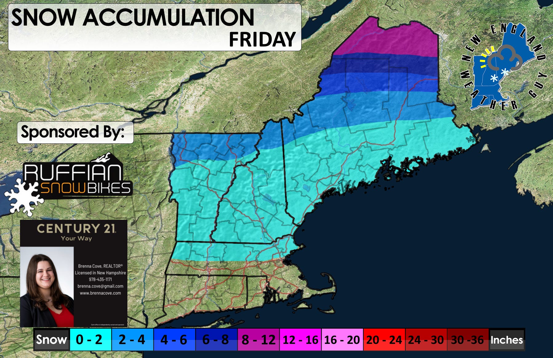
This storm system has grown quite a bit on the models to where we are now counting in the double digits for snow amounts for the far north. So… here is how things look to play out:
Precipitation moves into southern New England later tonight in the form of rain showers. This is far ahead of the bulk of the system which moves into northern New England early Friday morning. This will lead the way for an elongated area of precipitation running north to south that will spread across the region during the late morning into the afternoon. This will bring rain, sleet, freezing rain, and snow.
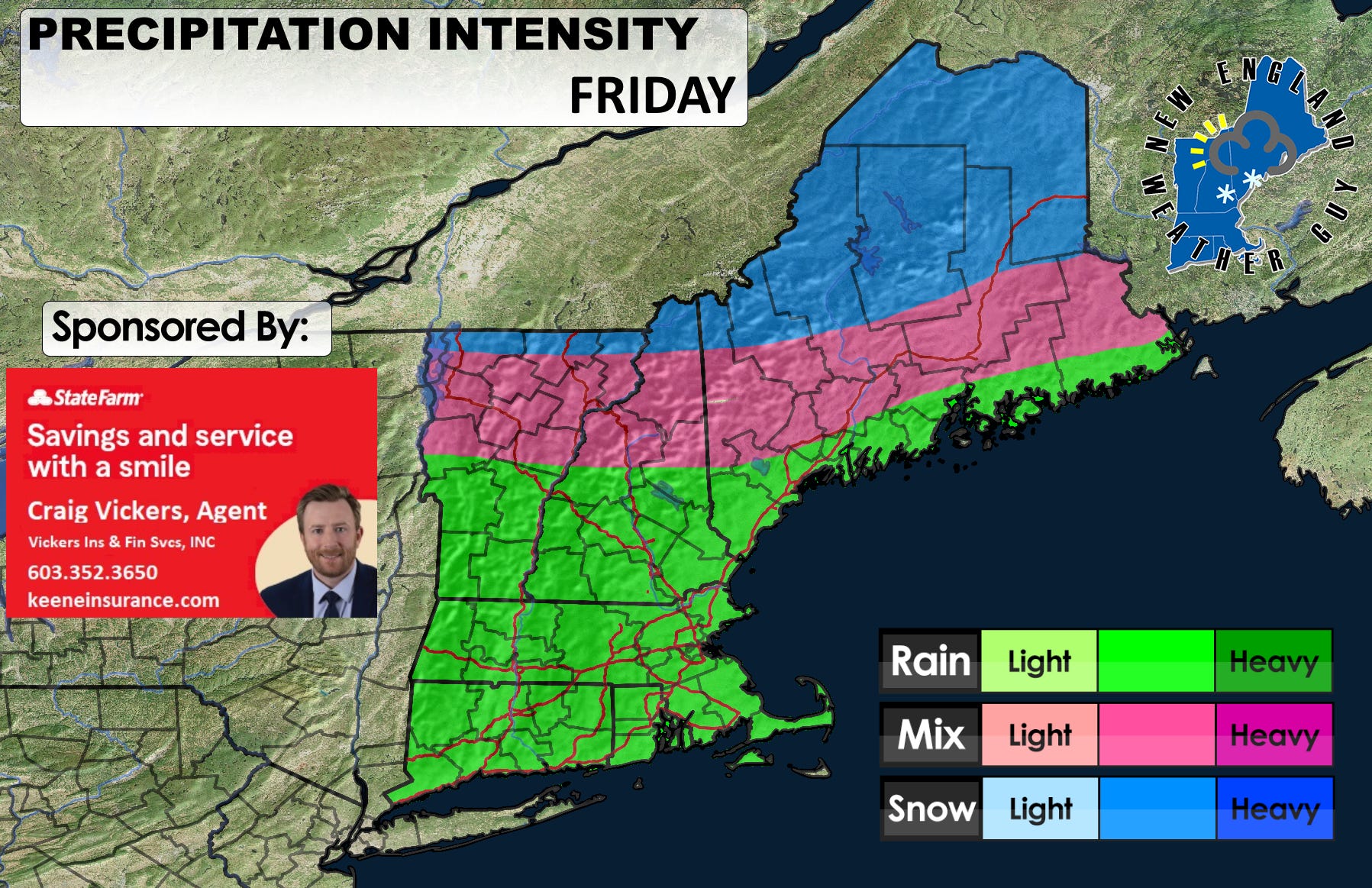
As far as totals go, we are looking at mainly far northern New England as well as the higher elevations. Freezing rain will be mixed in where I have indicated the “Mix” area on the attached map. I am not expecting ice storm amounts of freezing rain, but mixed in with the rest of the precipitation, it will be enough to make things slick.