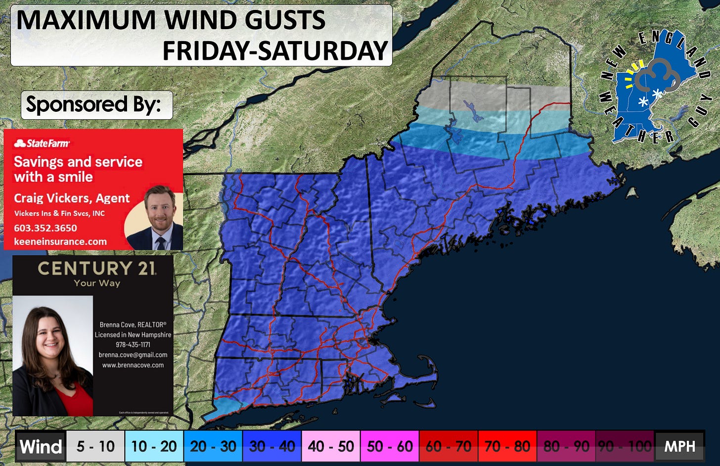
FRIDAY-SATURDAY UPDATE
Issued Thursday afternoon
My apologies for being later than expected today. Lots of stuff on my plate today. Moving right into it, there’s a storm coming. It’s a pretty big one, but still has a lot of uncertainty. This is another one of those where the main low is off to the west, it fizzles out, then a secondary low takes over from the ocean. Same set up as the last one and we saw how that played out for southern New England.
TIMING: We start to see precipitation want to move into western Mass from the west around 7pm tomorrow evening. This quickly spreads east across the state and begins entering VT around 10pm.
1am Saturday we see the heavy snow taking over in southwestern NH, and central Vermont. By 4am we see heavy rain in southern New England, heavy sleet and freezing rain with mixed precipitation in Massachusetts, and heavy snow from the MA/NH, MA/VT border on north. This only lasts a short time before the rain/snow line creeps north. By this time, we also have the heavier snow bands working their way into western Maine. Snow continues most of the day Saturday with random heavy bands and snow showers expected. All pulls out of the region by early Sunday morning.
P-TYPES: Snow for the north. Snow and sleet for central areas. Rain for CT, RI, and south coast of MA to include the Cape. Precipitation is likely to be heavy at times.
WINDS: Average of 30-40mph gusts with some a little higher in the 50mph range at the higher elevations and the coast.


